High-speed, sophisticated aeronautical engineering with next-generation HTDEM systems
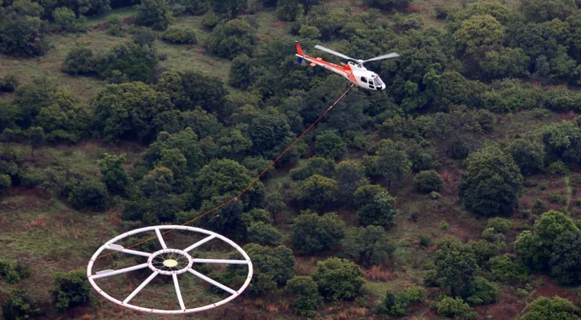
At Vortex Geoscience Consultancy, we harness high-speed, sophisticated aeronautical engineering combined with next-generation HTDEM (Helicopter Time-Domain Electromagnetic) systems to deliver unparalleled subsurface insights.
What We Offer
- Advanced HTDEM Technology: Cutting-edge airborne systems capable of detecting subtle geological variations with precision.
- Rapid Data Acquisition: High-speed aerial surveys that cover vast terrains efficiently, reducing project timelines.
- Comprehensive Subsurface Imaging: Mapping of mineral deposits, groundwater resources, and structural geology.
- Environmental Applications: Supporting sustainable land use, groundwater monitoring, and ecological assessments.
Why It Matters
Our airborne geophysical surveys provide clients with fast, reliable, and high-resolution data, enabling informed decisions in exploration, environmental management, and infrastructure development. By integrating aeronautical engineering with geoscience expertise, we deliver solutions that are both innovative and sustainable